Featured products
-
The Night Sky Planisphere | Southern Hemisphere Sky Chart by David Chandler
Regular price $24.95 AUDRegular priceUnit price per$29.95 AUDSale price $24.95 AUDSale -
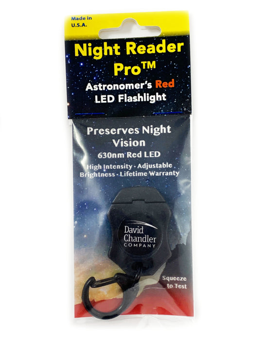
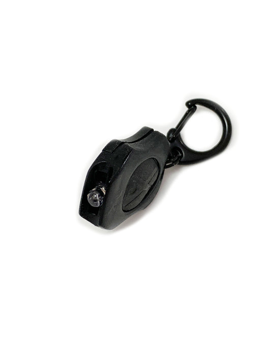
Night Reader Pro Red planisphere Night reading light
Regular price $24.95 AUDRegular priceUnit price per$24.95 AUDSale price $24.95 AUD -
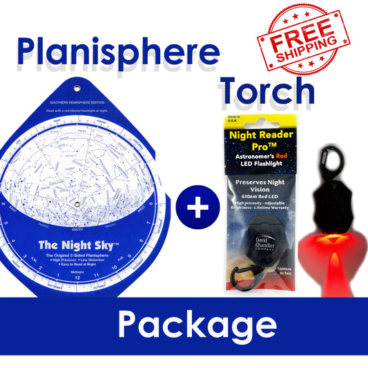
The Night Sky Planisphere & Night reader Pro Red Torch Package
Regular price $47.95 AUDRegular priceUnit price per$55.95 AUDSale price $47.95 AUDSale -
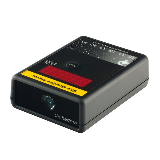
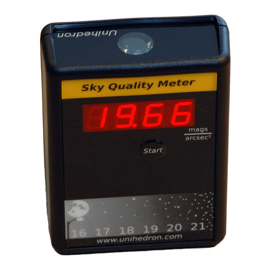
Sky Quality Meter with Lens | Measure Night Sky Brightness | SQM-L
Regular price $239.95 AUDRegular priceUnit price per$239.95 AUDSale price $239.95 AUD

In a nutshell
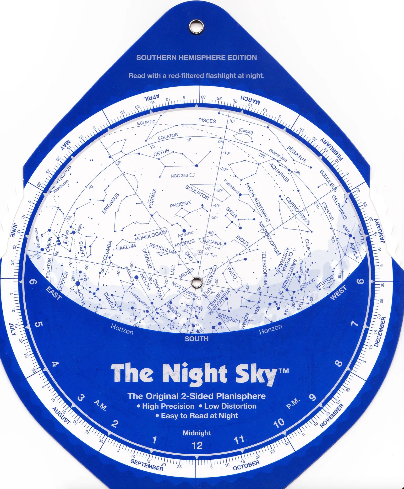
What is a planisphere?
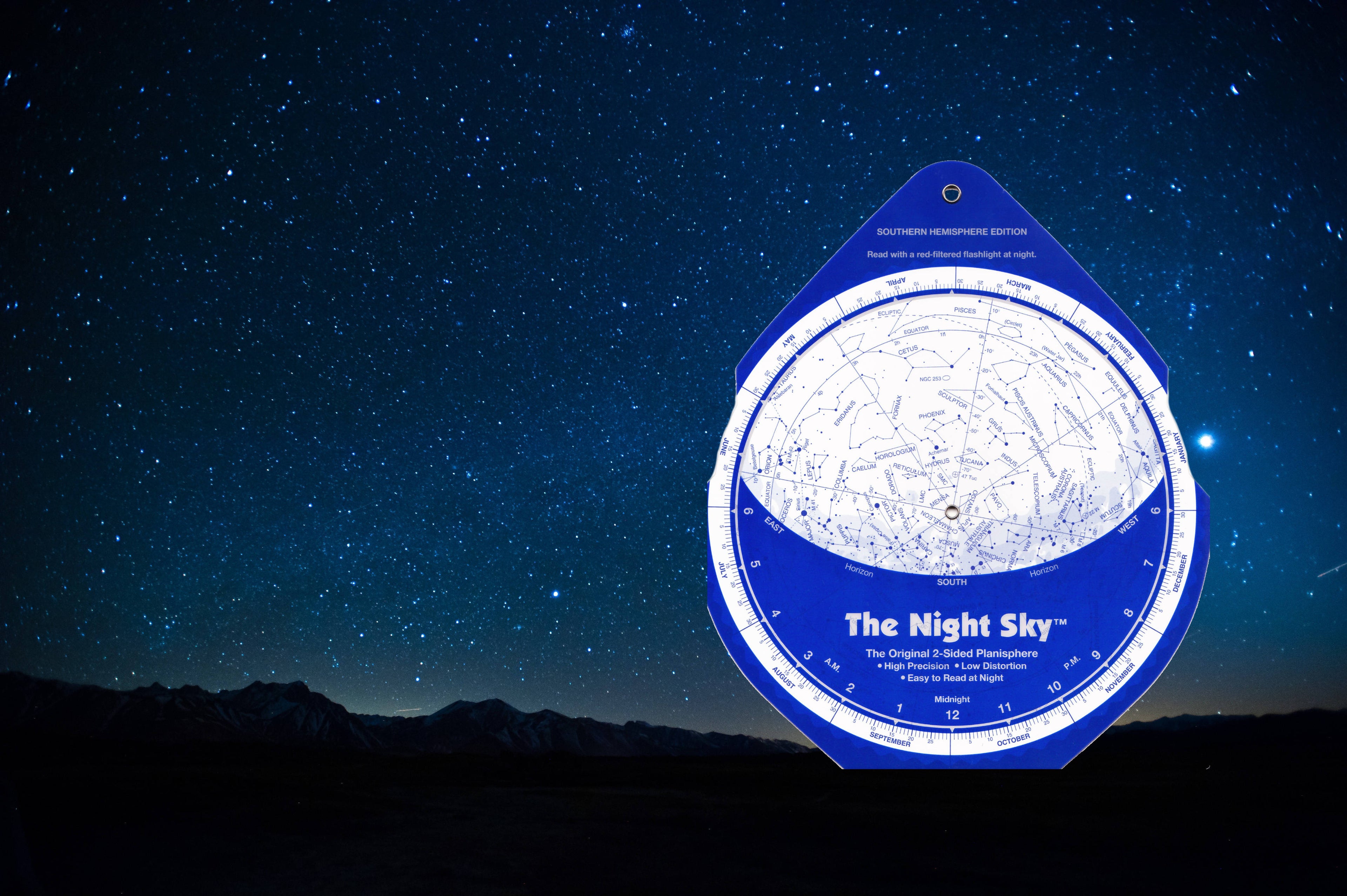
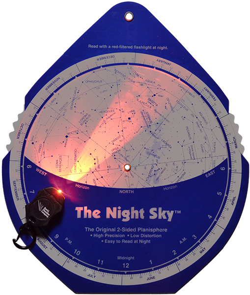
A planisphere, also called a Star Chart, Sky Chart or sometimes a Star Map is a flat multi-part chart that displays the stars visible from a particular latitude for any time and date. Our unique planisphere, The Night Sky™, pioneered the use of a two sided map projection to produce a low-distortion, simple to use constellation map to the night sky. With The Night Sky™ sky chart even a newcomer will be finding constellations in the night sky within a few minutes!
All of our planispheres are manufactured in the USA of the best materials to last long and retain their accuracy and usability.
Planisphere or App?
Now that smartphones and tablets have become ubiquitous many people ask us why we don’t publish a planisphere app instead of continuing to sell physical planispheres. The answer is that, in this case, there are several advantages to the physical format of our sky chart. Many of the apps are pretty amazing and a lot of fun to play with. Some are better than others, but they all have a few ingrained limitations that the format just can’t quite overcome.
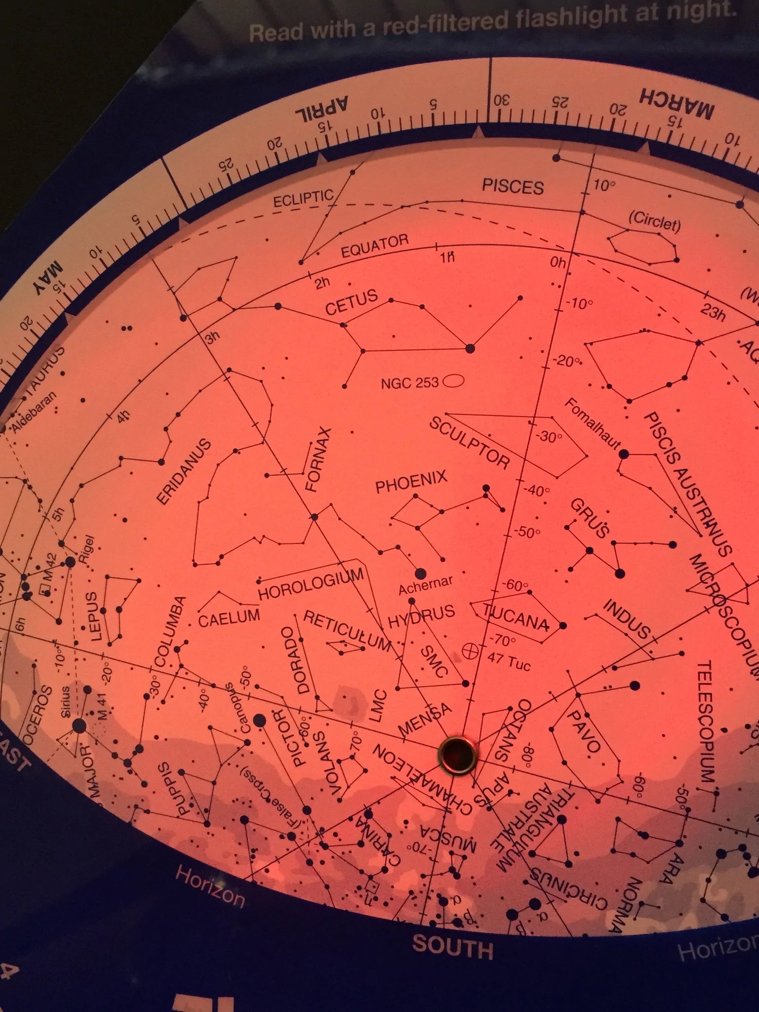
• One of the most important limitations is that the backlighting that makes phone displays work is very rich in short wavelength blue light. Even with the brightness turned down, night mode and using the “red mode” included with many apps there is a surprising amount of blue and near UV light being beamed straight into your eyes. While this is never really a good thing, it is of particular disadvantage to your night vision, which can take 10-15 min to recover. This in turns limits the eye's ability to see faint stars.
• Unfortunately, many of the apps we have seen suffer from quite a bit of distortion.
When this is the case it is very difficult to see in the sky what you see in your phone display. This can be consummately frustrating to beginners and our constellation map corrects for this.
• A physical planisphere shows you all the context at once. Rather than just the narrow view from your phone screen: you can see the adjacent stars and constellations without having to swing your arm back and forth repeatedly.
• A physical planisphere can “time-travel”. You can quickly and easily move time up and back to see where objects will be in the sky at different times. You can get a much better sense of the apparent movement of objects across the heavens simply by rotating the star map setting back and forth. As we just mentioned, this “time-travel” ability can be used plan ahead which is particularly helpful in setting up for astrophotography shots or planning an evening’s observing, or simply to find out if a particular object you are interested in will be visible on a particular night and time.
Planispheres designed to be used!
•Unlike coffee-table planispheres, The Night Sky planisphere is printed with dark stars on a light background, for easy nighttime readability.
• The constellations are drawn simply, emphasising the brighter stars which makes them easy to recognize and locate with the naked eye or entry level equipment.
• Coordinate grid lines are shown without being intrusive. Coordinates are shown on the sky chart because they can be useful for cross referencing with star atlases.
• A selection of deep sky objects for binocular viewing is included. It is important to point out to beginners that the best first telescope is a pair of binoculars. You may already have what it takes to start observing tonight!
•The Night Sky planisphere is larger than it looks! The map scale is larger than on similar size planispheres because the whole sky does not have to be shown on a single star map.
The Night Sky planisphere is widely recognised by the amateur astronomy and educational communities as the overall best planisphere and constellation map on the market.